
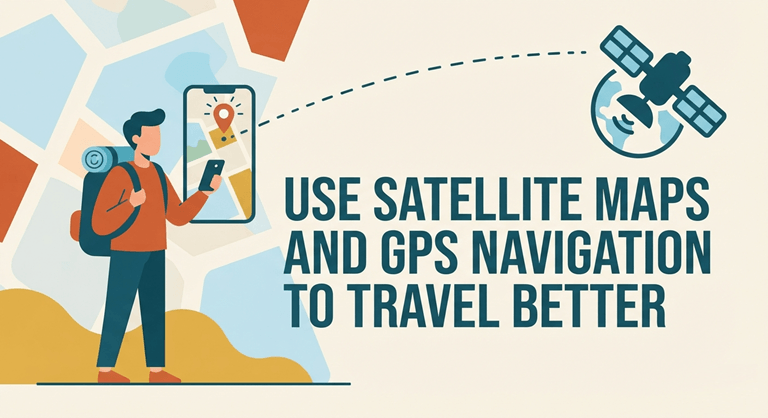
Use Satellite Maps and GPS navigation to travel better
Traveling is now easier than ever, but it also has its problems. You might only have a place’s name but not know the exact address. Traffic may unexpectedly make your trip slower. There are times when an Internet signal may be weak in areas you don’t know, and even on a good map, you may not know what a place actually looks like. That is why many travelers now use live location tools and GPS navigation alongside satellite maps. If you use the right app, your phone can help you find out more about a destination before you take off, let you know what you need to see on the way there, save important routes, and more.
Find out about your destination before you get there.
Suppose you were to take a trip to a city you have never been to on a weekend. A basic map will notify you of the roads that go there, but you may want to view the surrounding area, know the terrain, look for helpful places to stop off, and see if there is any traffic that could impact your trip.
For those who wish to have a more detailed map experience, there are several of these tools combined in Live Earth Satellite View Maps by MZ Tech.
It offers various options for seeing cities, roads, and landscapes, with Earth Map, 3D Map, and 3D Terrain. When you don’t need to know just street names and lines, a 3D perspective can be helpful to better understand an unfamiliar place.
The Route Planner will help you plan your route before you begin your journey. The Traffic Map and Live Traffic features can also help you visualize the situation if road conditions are significant:
Great for daily rides to work and extended journeys. When traffic clashes, even a familiar route can be inconvenient, so it’s better to know road conditions before you leave.
Voice Map is another convenient navigation option when traveling. Voice guidance can help decrease the repetitive task of constantly looking at the screen while en route to your destination.
The app also features an Address Finder, handy for those who know the name of a location but want to find the right address. Nearby Places helps you find helpful locations when you get to an unfamiliar place.
Distance Measure is useful when you are thinking of traveling and need to know the distance between two locations.
Other nice features are Saved Routes and Recent Routes for frequent travelers. Popular trips can be organized in a more convenient way so that they are easier to access without having to search for them over and over.
EV Charging Stations is another great resource for EV drivers. If you are traveling outside of your normal area, it can be much easier to plan your trips if you know where charging points could be.
The app features Speedometer, HUD Speedometer, Speed Tracking and Speed Alerts for drivers. These features are an addition to navigation and map exploration and put driving awareness features in the same location.
Other features include Weather, Compass, STD Codes, and Ask AI. These features give more to the experience than a satellite map, whether you are checking the Weather before you leave, getting directions, or using one of the additional features of the app.
Install Live Earth Satellite View Maps and learn what you like best about the 3D Map of the Earth, such as viewing traffic, planning trips, finding local attractions, and storing your favorite driving resources on your phone.
Awareness of location and surroundings
There is nothing more demoralizing than coming to a place and finding that you don’t know exactly where you are. Perhaps two streets share the same name, maybe you need to identify yourself in order to know where you want to go next, or maybe you’re in a big area, and you need to get to wherever it is.
Live Satellite Location Maps by VertixSoft focuses on location discovery and convenience of everyday travel.
It has a Current Location function that will give the user an understanding of their location, and Address Finder will aid the user in searching for a specific destination. This may come in handy if you’re in a new city, a busy neighborhood or even an area you don’t usually go.
The Satellite View and 3D Map features in the app enable your users to explore the area, instead of just a basic map showing some roads. A satellite or 3D view may help to grasp the local road network, environment, and the layout of a location.
When it’s time to hit the road, Voice Navigation can help with directions. Voice control can be more convenient for people who are driving regularly, as they can avoid constantly looking at the screen at each turn.
The app’s Traffic Map feature provides users with one more handy tool before they depart. If the place you are planning to visit is on the opposite side of the town, traffic information prior to the trip can inform you of the traffic situation so you can plan accordingly.
The Speedometer is helpful when driving, and the Compass provides instant directions when traversing an unknown area or wandering through the countryside.
Traveling is also an opportunity to explore your surroundings. The Tourist Places feature can help visitors to a new area find interesting places to visit.
Weather Updates can assist you in getting information on the current conditions and make preparations before leaving the house. Weather can affect a long journey or even a simple trip to the sights and scenes, and can be a useful addition to maps.
There is also a library of common features for the app. World Clock may come in handy if you need to know the time in another country, and Currency Converter is handy if you need to convert currencies for an international trip.
In addition to navigation, tools like QR Scanner, Sound Meter, and Sensor Info add additional functionality to STD Codes and Country Codes that allow for quick access to telephone-related information.
Several of these features are great for having all in one place instead of each being a separate app for a small task.
If you are constantly looking for your current location, addresses, satellite maps, touWeathercations, Weather, or useful travel information, you will want to pre-load these location tools with Get Live Satellite Location Maps for your next trip.
It allows you to track your journey and save these routes to be used later.
For some journeys, the destination is not the only factor. You might consider keeping a record of where you went, a helpful route for future reference, or having access to maps if mobile data is poor.
Live GPS Satellite View Maps by The Apps Land offers tools for people who want to navigate, track, and save their journeys.
The Self Tracking feature may aid in tracking the movement of users on a journey. When exploring a new city or a route that you wish to recall, tracking can be helpful for recording your journey.
Past trips can be saved for later with Saved Tracks. This is useful if you discover a route you would like to use again or want to retain information about a particular trip.
The app also has Route Navigation and Saved Routes. Frequent trips can be saved, saving time when visiting places you are familiar with.
Offline Maps is one of the most helpful tools for travelers. Mobile internet might be fine in the city, but won’t work as well when traveling on a road trip or in less populated regions. Being able to access maps offline, therefore, can be a helpful feature when traveling.
The Subway Map is another tool to learn about the transportation system in a city if you are an urban traveler.
Live Traffic allows the driver to know road conditions, and the built-in Speedometer offers speed information while the driver is traveling.
Download its app for Earth Map, 3D Earth and Height Map for those who want to explore destinations visually. When viewing terrain and elevation, a height map can provide yet another visual perspective, and when exploring terrain virtually, 3D Earth can make those explorations more interesting.
For those seeking a particular place, Location Finder offers a handy search function. Useful areas may be saved for further use with Saved Area, and Area Finder is useful when working with a specific area.
Tourist Places will help travelers find attractions, and Weather will help them check the Weather before traveling.
Other features, like Compass and STD Codes, complement the GPS and map use as simple everyday tools.
Install Live GPS Satellite View Maps, and discover how its GPS tools can enhance your next trip with its trip tracking, route saving, offline maps, traffic, and 3D Earth.
Explore in multiple ways with one phone. Explore differently with one phone.
As with any tool, the use of maps has evolved. Maps aren’t limited to when you get lost. They help us prepare for a trip, tour a before-and-after, check road conditions, see what attractions are available, label, save previous trips, and understand where we are.
If you’re into earth maps, 3D terrain, route planning and driving features, Live Earth Satellite View Maps has a wide range of features that are helpful to users. If primary needs are location discovery, address search, satellite views, a nd travel utilities, then Live Satellite Location Maps is another viable choice. For those who prefer self-tracking, saved tracks, offline maps, and GPS route navigation, Live GPS Satellite View Maps emphasizes tracking and managing journeys more.
For anyone who has traveled, it’s essential to have a map and the right GPS tools handy to help navigate through new areas and make every trip more enjoyable.
Popular on OTW Right Now!



About The Author

Gagan Bhangu
Founder of otechworld.com and managing editor. He is a tech geek, web-developer, and blogger. He holds a master's degree in computer applications and making money online since 2015.